Visions for Capitol East
Des Moines’ Capitol East neighborhood is one of three neighborhoods on the east bank of the Des Moines River that have recently gone through the City’s Neighborhood Revitalization Program. It is part of the Viva East Bank! neighborhood coalition along with the Capitol Park and Martin Luther King Jr. Park neighborhoods. This report articulates spatial strategies and options for Capitol East based on goals and priorities from the 2014 Capitol East Neighborhood Charter Plan Update, prepared by students and faculty from the Iowa State University Community and Regional Planning Department in cooperation with the Capitol East Neighborhood Association and the City of Des Moines.
Historical documents show that Capitol East was originally part of the Des Moines downtown core, located at the eastern end of a continuous grid terminating in the west with the recently revitalized Western Gateway area. Capitol East today is, however, a spatial island, cut off by Interstate 235 and the Iowa State Capitol Grounds. Strategies presented in this report reconnect Capitol East to the historic and contemporary fabrics of Des Moines, using spatial strategies including nodes, corridors, networks, and blocks to integrate the neighborhood plan priorities of housing, infrastructure, youth, community building, and economic development.
These strategies build on existing assets and reveal hidden opportunities; they provide spatial guidelines for the integration and prioritization of specific spatial projects. During the next phase of work, the CDL will partner with local artists, organizations, and ISU classes to engage specific “catalyst” sites through temporary and permanent installations and designs.
Back to Community Revitalization
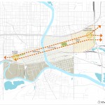
- Downtown Axis | Eje Del Centro de la Ciudad © ISU Community Design Lab
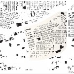
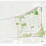
- Figure Ground | Densidad Del Suelo © ISU Community Design Lab
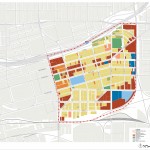
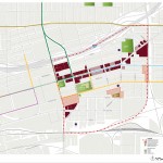
- Land Use | Uso Del Suelo © ISU Community Design Lab
- Open Space | Espacio Abierto © ISU Community Design Lab
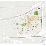
- Assets | Bienes © ISU Community Design Lab
- Building Condition | Estado de las Edificaciones © ISU Community Design Lab
- Infrastructure Condition | Condicion de Infraestructura © ISU Community Design Lab
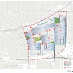
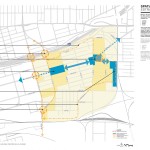
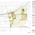
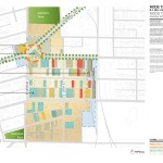
- Spatial Strategies | Estrategias Espaciales © ISU Community Design Lab
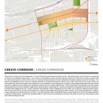
- Create Corridor | Crear Corredor © ISU Community Design Lab
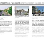
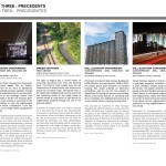
- Precedents | Precedentes : Create Corridor (Crear Corredor) © ISU Community Design Lab
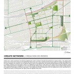
- Create Network | Creacion de Redes © ISU Community Design Lab
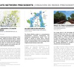
- Precedents | Precedentes : Create Network (Creacion de Redes) © ISU Community Design Lab
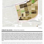
- Create Blocks | Crear Bloques © ISU Community Design Lab
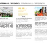
- Precedents | Precedentes : Create Blocks (Crear Bloques) © ISU Community Design Lab
- Create Nodes | Crear Nodos © ISU Community Design Lab
- Node One | Nodo Uno : Capitol East Gateway © ISU Community Design Lab
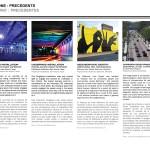
- Precedents | Precedentes : Node One (Nodo Uno) © ISU Community Design Lab
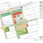
- Node Two | Nodo Dos : Governor’s Square © ISU Community Design Lab
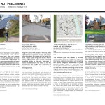
- Precedents | Precedentes : Node Two (Nodo Dos) © ISU Community Design Lab
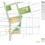
- Node Three | Nodo Tres : BF Mill Park © ISU Community Design Lab
- Precedents | Precedentes : Node Three (Nodo Tres) © ISU Community Design Lab
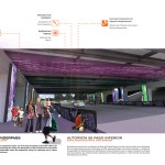
- Highway 69 Underpass Art Installation | Instalación Arte por el Paso Inferior © ISU Community Design Lab
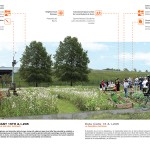
- East 15th & Interstate 235 Natural Gateway | Este Calle 15 & I-235 Pasarela Natural © ISU Community Design Lab
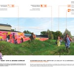
- Intersection of East 15th & Grand Avenue Mural & Land Art Project | Interseccion del Este de la Calle 15 & Avenida Grand Proyecto de Arte Mural & Tierras © ISU Community Design Lab
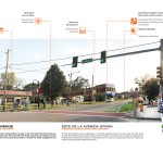
- East Grand Avenue Pedestrian Corridor | Este de la Avenida Grand Corredor de la Peatonal © ISU Community Design Lab
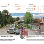
- Intersection of Grand & Hubbell The Eastern Gateway | Interseccion de Grand & Hubbell Pasarela Este © ISU Community Design Lab
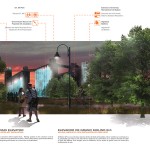
- B.F. Mill Grain Elevator & Park with Video Art Installation | Elevador de Grano Molino B.F. & Parque con Instalación de Video Arte © ISU Community Design Lab

 Previous Post